Posted by Admin on 28-10-2022 in Shiksha hub
Ph.D. in Remote Sensing & Gis Introduction Admission Registration, Eligibility, Duration, Fees, Syllabus 2024
Introduction about Ph.D. in Remote Sensing & Gis
A Ph.D. in Remote Sensing and Geographic Information Systems (GIS) is a specialized doctoral program that focuses on advanced research and expertise in the fields of remote sensing and GIS technology. This program is designed for individuals who seek to make significant contributions to the understanding and application of these technologies in various domains such as environmental science, natural resource management, urban planning, agriculture, and more.
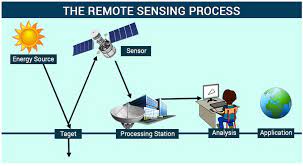
Remote Sensing: Remote sensing involves the collection and interpretation of information about the Earth's surface from a distance, typically using satellite or aerial sensors. This field encompasses the acquisition, analysis, and interpretation of data that helps researchers understand and monitor the Earth's physical and environmental characteristics. Applications of remote sensing range from mapping land cover and land use changes to monitoring climate patterns and assessing natural disasters.
Geographic Information Systems (GIS): GIS is a technology that integrates spatial data (maps) with attribute data (information about the features represented on the maps). GIS allows users to analyze and visualize spatial patterns and relationships, making it a powerful tool for decision-making and problem-solving. Applications of GIS are diverse, including urban planning, environmental modeling, transportation planning, and more.
Ph.D. Program Overview: A Ph.D. program in Remote Sensing and GIS typically involves a combination of coursework, comprehensive exams, and original research. Students are expected to develop a deep understanding of the theoretical foundations and practical applications of remote sensing and GIS technologies. The research component of the program involves the identification of a specific research question, data collection and analysis, and the dissemination of findings through scholarly publications.
Research Areas: Ph.D. candidates in this field may choose to specialize in various research areas, such as:
Environmental Monitoring: Studying the impact of human activities and natural processes on the environment using remote sensing and GIS.
Natural Resource Management: Assessing and managing natural resources, including forests, water bodies, and agricultural lands, through spatial analysis.
Urban and Regional Planning: Using GIS to analyze and plan for sustainable urban development and regional spatial patterns.
Climate Change Studies: Investigating the effects of climate change on the Earth's surface and developing mitigation and adaptation strategies.
Disaster Management: Utilizing remote sensing for disaster risk assessment, monitoring, and response.
Career Opportunities: Ph.D. graduates in Remote Sensing and GIS are well-equipped for careers in academia, research institutions, government agencies, and private industry. They may work as researchers, professors, environmental consultants, GIS analysts, or in leadership roles developing and implementing geospatial technologies.
How can I apply for admission to Ph.D. in Remote Sensing & Gis program
Applying for admission to a Ph.D. program in Remote Sensing and GIS typically involves several steps. The specific requirements and procedures may vary between universities, so it's important to carefully review the admission guidelines provided by the institution of your choice. Here is a general guide on how you can apply:
Research Programs and Universities: Start by researching Ph.D. programs in Remote Sensing and GIS at various universities. Look for programs that align with your research interests and career goals. Consider factors such as faculty expertise, available resources, and the overall reputation of the program.
Meet Admission Requirements: Check the admission requirements for each program you are interested in. Typically, Ph.D. programs have specific prerequisites, such as a master's degree in a related field, a strong academic record, and relevant research experience. Some programs may also require standardized test scores (e.g., GRE) and letters of recommendation.
Prepare Application Materials: Gather all the required application materials. These commonly include:
Transcripts: Provide official transcripts from all previous academic institutions attended.
Resume/CV: Highlight your educational background, research experience, and any relevant work experience.
Letters of Recommendation: Obtain letters of recommendation from professors or professionals who can speak to your academic and research capabilities.
Statement of Purpose: Write a compelling statement outlining your research interests, career goals, and why you are interested in pursuing a Ph.D. in Remote Sensing and GIS.
Research Proposal: Some programs may require a detailed research proposal outlining your intended area of research.
Standardized Tests: If required, register and take any standardized tests (e.g., GRE). Be sure to send your scores directly to the institutions where you are applying.
Online Application: Complete the online application form for each university. Most institutions have an online application portal where you can submit your information and upload supporting documents.
Application Fee: Pay the application fee as specified by each university. Some institutions may offer fee waivers based on financial need or other criteria.
Submission Deadline: Be aware of the application deadline for each program. Submit your application well before the deadline to ensure it is considered.
Interview (if required): Some programs may require an interview as part of the admission process. Prepare for the interview by reviewing your research interests, relevant experiences, and why you are a suitable candidate for the program.
Check Application Status: After submitting your application, regularly check the application status through the university's online portal. This will help you stay informed about any additional requirements or the decision timeline.
Financial Aid and Scholarships: Explore available financial aid options, scholarships, or assistantship opportunities offered by the university or external organizations.
Remember to tailor your application to each specific program and showcase how your background and aspirations align with the objectives of the Ph.D. in Remote Sensing and GIS. Good luck with your application!
What is the eligibility for Ph.D. in Remote Sensing & Gis
The eligibility criteria for a Ph.D. in Remote Sensing and GIS can vary among universities and institutions. However, I can provide you with a general overview of the typical eligibility requirements that candidates may encounter:
Educational Qualifications:
A Master's degree in a related field is often a prerequisite for admission to a Ph.D. program in Remote Sensing and GIS. The related fields may include Geography, Environmental Science, Geoinformatics, Earth Sciences, or a closely related discipline.
Some programs may consider exceptional candidates with a strong academic background in a relevant Bachelor's degree and significant research or work experience.
Minimum GPA (Grade Point Average):
Universities often specify a minimum GPA requirement for admission. This could be on a 4.0 scale or an equivalent grading system.
Research Experience:
Candidates are generally expected to have a background in research, demonstrated through a Master's thesis or significant research projects. Publications or conference presentations related to Remote Sensing and GIS can strengthen your application.
Letters of Recommendation:
Submission of letters of recommendation from academic or professional references who can attest to your research and academic capabilities is commonly required.
Statement of Purpose:
A well-articulated statement of purpose outlining your research interests, academic and professional background, and reasons for pursuing a Ph.D. in Remote Sensing and GIS is typically part of the application.
Research Proposal:
Some programs may require a detailed research proposal that outlines your intended area of research for the Ph.D. This proposal should align with the research interests of the faculty members in the department.
Standardized Test Scores:
While not always mandatory, some universities may require standardized test scores, such as the Graduate Record Examination (GRE) or other relevant tests. Check the specific requirements of the programs you are interested in.
Language Proficiency:
If English is not your first language, you may need to demonstrate proficiency through standardized tests such as the TOEFL (Test of English as a Foreign Language) or IELTS (International English Language Testing System).
Interview (if required):
Some institutions may conduct interviews as part of the selection process. This interview may focus on your research interests, academic background, and suitability for the Ph.D. program.
It's important to note that meeting the minimum eligibility criteria does not guarantee admission. Admissions decisions are often based on a holistic assessment of the candidate's academic achievements, research potential, and fit with the program's objectives. Therefore, carefully review the specific eligibility requirements of the Ph.D. programs you are interested in applying to and contact the admissions office for any clarification or additional information.
How long does it takes to complete a Ph.D. in Remote Sensing & Gis program
The duration to complete a Ph.D. in Remote Sensing and GIS can vary depending on several factors, including the specific requirements of the program, the nature of the research, the individual progress of the student, and the policies of the university. However, a rough estimate of the timeline for completing a Ph.D. program is typically between 3 to 5 years.
Here's a breakdown of the general timeframes:
Coursework (1-2 years):
In the initial phase of the Ph.D. program, students usually complete coursework to build a solid foundation in Remote Sensing, GIS, and related research methods. The duration of coursework can vary, but it commonly takes around 1 to 2 years.
Comprehensive Exams (Varies):
After completing coursework, students may need to pass comprehensive exams to demonstrate their understanding of the theoretical and methodological aspects of the field. The time taken to prepare for and pass these exams can vary.
Research Proposal and Proposal Defense (Varies):
Developing a research proposal and successfully defending it before a committee is a significant milestone in a Ph.D. program. The time taken to formulate and gain approval for the research proposal can vary based on the complexity of the research topic.
Research and Dissertation (2-4 years):
The bulk of the Ph.D. program is dedicated to original research. Conducting the research, collecting and analyzing data, and writing the dissertation typically take the majority of the program's duration. The timeline for this phase can vary widely based on the scope and nature of the research.
Dissertation Defense (Varies):
Once the research is complete, students must defend their dissertation before a committee. The time taken to prepare for and successfully defend the dissertation can vary.
It's important to note that these timelines are generalizations, and actual completion times can be influenced by factors such as the availability of resources, the level of research support, the student's commitment and efficiency, and the specific requirements of the Ph.D. program.
Additionally, some students may complete their Ph.D. faster if they enter the program with a strong foundation in the subject matter or if they are able to dedicate significant time to their studies. On the other hand, external factors such as unexpected challenges or changes in research direction can potentially extend the completion time.
What are potential career opportunities after Ph.D. in Remote Sensing & Gis
A Ph.D. in Remote Sensing and GIS opens up a range of career opportunities in various sectors, including academia, research institutions, government agencies, and the private sector. Here are some potential career paths:
Academia and Research:
Professor/Researcher: Many Ph.D. graduates choose to pursue careers in academia, working as professors or researchers at universities and research institutions. They may teach, conduct research, and contribute to the academic community through publications and conferences.
Government Agencies:
Environmental Agencies: Ph.D. holders may work for government environmental agencies, contributing to projects related to environmental monitoring, natural resource management, and climate change assessments.
Geospatial Agencies: Government departments responsible for mapping, surveying, and geospatial data management often employ Ph.D. graduates for roles such as geospatial analysts or scientists.
Private Industry:
Geospatial Technology Companies: Companies specializing in geospatial technologies, remote sensing, and GIS solutions hire Ph.D. graduates for roles such as research and development, data analysis, and consulting.
Environmental Consulting Firms: Private firms engaged in environmental consulting often seek Ph.D. experts to contribute to projects related to land use planning, environmental impact assessments, and natural resource management.
Nonprofit Organizations:
Environmental and Conservation Organizations: Nonprofit organizations focused on environmental and conservation issues may employ Ph.D. graduates to contribute to research, policy development, and project implementation.
Urban Planning and Development:
Urban Planning Departments: Ph.D. graduates with expertise in GIS may find opportunities in urban planning departments, contributing to city planning, infrastructure development, and spatial analysis.
Agriculture and Forestry:
Agricultural Research: Ph.D. holders can work in research positions related to precision agriculture, using remote sensing and GIS to optimize crop management and resource utilization.
Forestry Departments: Careers in forestry may involve monitoring and managing forest resources, assessing biodiversity, and implementing sustainable forestry practices.
Disaster Management and Response:
Emergency Management Agencies: Ph.D. graduates may work with government agencies or nonprofit organizations focused on disaster management, using geospatial technologies for risk assessment, monitoring, and response.
International Organizations:
United Nations, World Bank, etc.: International organizations may offer opportunities for Ph.D. graduates to contribute to global initiatives in areas such as sustainable development, climate change adaptation, and disaster risk reduction.
Data Science and Analytics:
Data Science Roles: Ph.D. holders with strong quantitative skills may find opportunities in data science, applying their expertise in spatial data analysis to extract meaningful insights from large datasets.
Entrepreneurship:
Startups: Some Ph.D. graduates choose entrepreneurial paths, establishing their own companies or startups focused on innovative applications of remote sensing and GIS technologies.
These are just a few examples, and the versatility of a Ph.D. in Remote Sensing and GIS allows graduates to contribute to a wide range of fields where spatial analysis and geospatial technologies are essential. The specific career path chosen often depends on individual interests, expertise, and professional goals.
Syllabus of Ph.D. in Remote Sensing & Gis
The specific syllabus for a Ph.D. in Remote Sensing and GIS can vary between universities and programs. However, I can provide a general outline of potential topics that might be covered during each semester of a Ph.D. program. Keep in mind that this is a hypothetical representation, and the actual syllabus will depend on the policies and curriculum of the institution offering the program:
Semester 1:
Advanced Remote Sensing Techniques:
In-depth study of advanced remote sensing technologies, including radar, lidar, and hyperspectral imaging.
Understanding the principles of data acquisition, processing, and interpretation.
Spatial Data Analysis:
Advanced techniques for analyzing spatial data using GIS.
Spatial statistics, spatial autocorrelation, and interpolation methods.
Research Methodology:
Introduction to research design, methods, and techniques.
Ethical considerations in research and data collection.
Elective 1:
Coursework related to the student's specific research interests or foundational courses in the field.
Seminar Series:
Attendance and participation in seminars on current research trends in Remote Sensing and GIS.
Semester 2:
Advanced GIS Applications:
Specialized applications of GIS in areas such as urban planning, environmental modeling, and natural resource management.
Integration of GIS with other technologies.
Spatial Modeling and Simulation:
Development and implementation of spatial models for simulating real-world phenomena.
Application of models to address research questions.
Literature Review:
Systematic review of existing literature in the field of Remote Sensing and GIS related to the student's research area.
Identification of research gaps and formulation of research questions.
Elective 2:
Further specialization in a specific area of Remote Sensing and GIS.
Seminar Series:
Continued participation in seminars and research discussions.
Semester 3:
Advanced Topics in Remote Sensing:
Specialized topics such as change detection, object-based image analysis, and sensor calibration.
Hands-on exercises with advanced software tools.
Advanced Geostatistics:
Advanced statistical methods for analyzing spatial patterns and relationships.
Geostatistical modeling and kriging techniques.
Proposal Development:
Formulation and development of the Ph.D. research proposal.
Proposal defense before a committee.
Elective 3:
Further specialization or interdisciplinary coursework.
Seminar Series:
Research updates and presentation of progress.
Semester 4 and Beyond:
Ph.D. Research:
Initiation and continuation of the original research project outlined in the research proposal.
Data collection, analysis, and interpretation.
Publication and Dissemination:
Preparation and submission of research papers to conferences and journals.
Participation in academic and research events.
Advanced Seminars:
Advanced seminars on specific topics related to the student's research.
Thesis Writing:
Ongoing writing and revision of the Ph.D. dissertation.
Thesis Defense:
Final defense of the Ph.D. dissertation before a committee.
It's important to note that the structure and content of the Ph.D. program can vary, and the above outline is a general representation. Prospective students should refer to the specific curriculum and requirements of the institution offering the Ph.D. in Remote Sensing and GIS.
Internship opportunities after completing Ph.D. in Remote Sensing & Gis
After completing a Ph.D. in Remote Sensing and GIS, individuals may explore various internship opportunities to gain additional practical experience, collaborate with industry professionals, and apply their research skills in real-world settings. Here are some potential internship opportunities for Ph.D. graduates in Remote Sensing and GIS:
Government Agencies:
Environmental Protection Agencies: Internships with government agencies responsible for environmental protection can involve working on projects related to land use monitoring, environmental impact assessments, and climate change studies.
Geospatial Departments: Internships with government geospatial departments provide hands-on experience in managing and analyzing spatial data for various applications.
Private Industry:
Geospatial Technology Companies: Interning with companies specializing in geospatial technologies allows Ph.D. graduates to apply their skills in a commercial setting. Tasks may include developing GIS applications, conducting spatial analyses, and contributing to research and development projects.
Environmental Consulting Firms: Internships with environmental consulting firms offer opportunities to work on projects related to environmental assessment, natural resource management, and geospatial analysis for private clients.
Research Institutions:
Research Centers and Labs: Internships with research institutions provide opportunities to collaborate on cutting-edge research projects, contribute to ongoing studies, and gain exposure to multidisciplinary research environments.
Universities: Collaborating with other research groups or departments within universities allows Ph.D. graduates to broaden their research experience and potentially explore postdoctoral opportunities.
Nonprofit Organizations:
Environmental and Conservation NGOs: Interning with nonprofit organizations focused on environmental and conservation issues provides a chance to work on projects related to sustainable development, biodiversity conservation, and community engagement.
Urban Planning and Development:
Urban Planning Departments: Internships with city planning departments or urban development agencies allow graduates to apply GIS skills to address urban challenges, such as transportation planning, infrastructure development, and spatial analysis for urban growth.
Agriculture and Forestry:
Agricultural Research Institutes: Internships in agricultural research institutions offer opportunities to apply remote sensing and GIS in precision agriculture, crop monitoring, and resource management.
Forestry Departments: Internships with forestry departments involve projects related to forest inventory, biodiversity monitoring, and sustainable forestry practices.
International Organizations:
United Nations Agencies, World Bank: Interning with international organizations provides exposure to global initiatives in areas such as sustainable development, disaster risk reduction, and climate change adaptation.
Data Science and Analytics:
Tech Companies: Internships in data science or tech companies allow Ph.D. graduates to apply their spatial data analysis skills in the broader context of data science, machine learning, and artificial intelligence.
Disaster Management and Response:
Emergency Management Agencies: Internships with agencies focused on disaster management provide opportunities to contribute to projects related to risk assessment, preparedness planning, and post-disaster response using geospatial technologies.
When seeking internship opportunities, Ph.D. graduates should leverage their research expertise, network with professionals in the field, and explore organizations that align with their research interests and career goals. Internships can serve as valuable stepping stones to postdoctoral positions, industry roles, or continued academic pursuits.
Scholarship and Grants for Ph.D. in Remote Sensing & Gis FAQ Ph.D. in Remote Sensing & Gis
Scholarships and Grants for Ph.D. in Remote Sensing & GIS:
University-specific Scholarships:
Many universities offer Ph.D. scholarships for outstanding candidates. These may cover tuition, living expenses, or research costs.
Government-funded Scholarships:
Government agencies and departments related to remote sensing, GIS, and environmental sciences may offer scholarships for Ph.D. students conducting research in these areas.
Research Council Funding:
Research councils at the national or regional level may provide funding for Ph.D. research projects, particularly those with a focus on advancing scientific knowledge.
Industry-sponsored Scholarships:
Companies involved in geospatial technology, environmental consulting, and related industries may offer scholarships to support Ph.D. research relevant to their interests.
International Scholarships:
Organizations such as Fulbright, DAAD, or the Commonwealth Scholarship Commission provide international scholarships for Ph.D. studies, including those in remote sensing and GIS.
Professional Associations and Societies:
Organizations like the International Society for Photogrammetry and Remote Sensing (ISPRS) or the American Society for Photogrammetry and Remote Sensing (ASPRS) may offer scholarships or grants for Ph.D. students.
Nonprofit Organizations:
Environmental and conservation-focused nonprofits may provide funding for Ph.D. research projects aligned with their mission.
Research Fellowships:
Research fellowships from organizations like the National Geographic Society or the European Space Agency (ESA) can support Ph.D. research in remote sensing and GIS.
Specific Research Project Grants:
Some grants are available for Ph.D. students working on specific research projects. These may be offered by government agencies, private foundations, or international organizations.
Conclusion
Ph.D. in Remote Sensing and GIS provides individuals with the knowledge and skills to become experts in these cutting-edge technologies, contributing to the advancement of our understanding of the Earth's dynamics and addressing real-world challenges through informed decision-making.
FAQ's
Q: Can I pursue a Ph.D. in Remote Sensing & GIS with a background in a different field?
A: Yes, many Ph.D. programs welcome candidates with diverse backgrounds. However, you may be required to take additional coursework to build a foundation in remote sensing and GIS.
Q: Are there online Ph.D. programs in Remote Sensing & GIS?
A: Some universities offer online or hybrid Ph.D. programs, allowing flexibility for working professionals or those unable to relocate.
Q: What is the typical duration of a Ph.D. in Remote Sensing & GIS?
A: The duration varies but is typically between 3 to 5 years, including coursework, research, and dissertation preparation.
Q: Are there opportunities for international collaboration during a Ph.D.?
A: Yes, many Ph.D. programs encourage or require international collaboration. This can involve research partnerships, conferences, or joint projects.
Q: What career paths can I pursue after completing a Ph.D. in Remote Sensing & GIS?
A: Career paths include academia, research institutions, government agencies, private industry (geospatial technology companies, consulting firms), nonprofit organizations, and international organizations.
Q: How can I find potential Ph.D. advisors or supervisors?
A: Explore the faculty profiles of universities offering Ph.D. programs in Remote Sensing & GIS. Contact professors whose research aligns with your interests to inquire about potential supervision.
Q: What skills are essential for success in a Ph.D. program in this field?
A: Strong analytical and research skills, proficiency in GIS and remote sensing tools, effective communication, and the ability to work independently are crucial for success.
Q: Are there conferences and workshops related to Remote Sensing & GIS that Ph.D. students can attend?
A: Yes, attending conferences such as the International Conference on Geoinformatics or the Esri User Conference provides opportunities to present research, network, and stay updated on industry trends.
How Shiksha Hub helps you in
-
 Student Counsellors
 -
 Career Counseling
 -
 Research
 -
 24/7 Support
 -
 Scholarships
 -
 Community